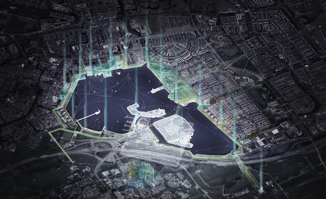
The Weerwater is Almere’s central inland lake that borders the city centre to the north and the future Floriade Terrain to the south. It is a unique cross-section of city and countryside, which is still not being used to its fullest potential. Currently, the city has its back to the Weerwater. In many places, walking or biking along the water is impossible and there are hardly any facilities along the shore. This creates a tremendous opportunity to transform the Weerwater area into a place where residents can enjoy sports, recreation and time together, forming a beating heart of Almere. It is a place that links the city centre and surrounding areas, giving Almere its identity.
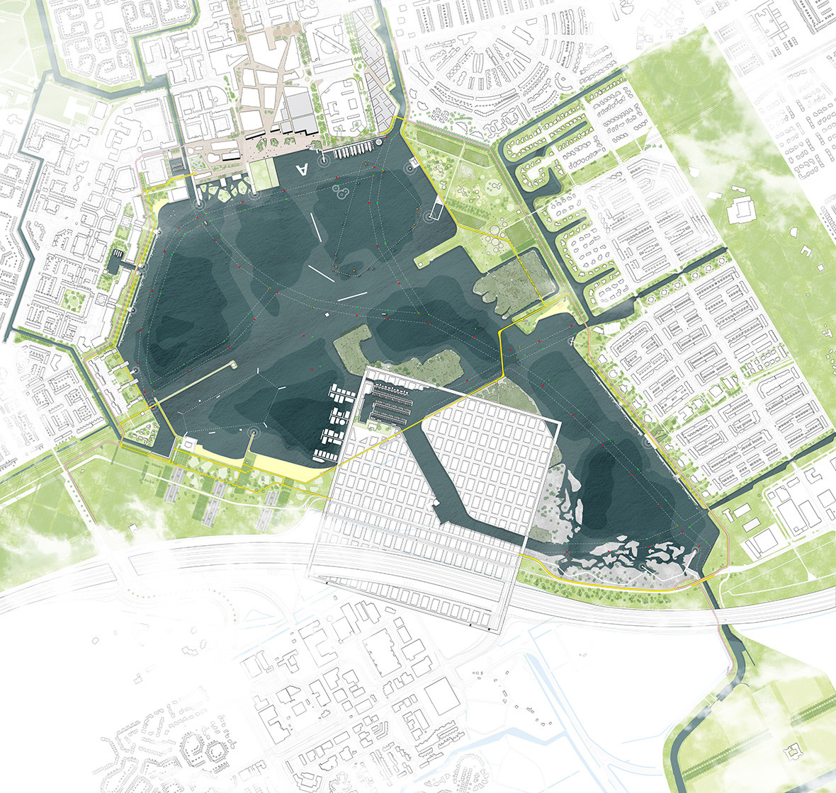
The assignment is to design a recognisable Weerwater Route (Rondje Weerwater) to support facilities and activities and to create trails for sports and recreation, connectors, bridges, gathering places and furniture. Thus, the “physical” Weerwater Route is intrinsically linked to the area’s revitalisation and programming. The goal is for the Route to provide an identity theme for Almere and surrounding residential areas. The Route’s development and design brings new possibilities to not only transform the city and the urban design of specific areas, but to improve its functional-spatial coherence. The transformation of neighbouring districts and the construction of new ones offers an excellent opportunity to make better use of the Weerwater Route’s central location, using it as a catalyst for urban development.
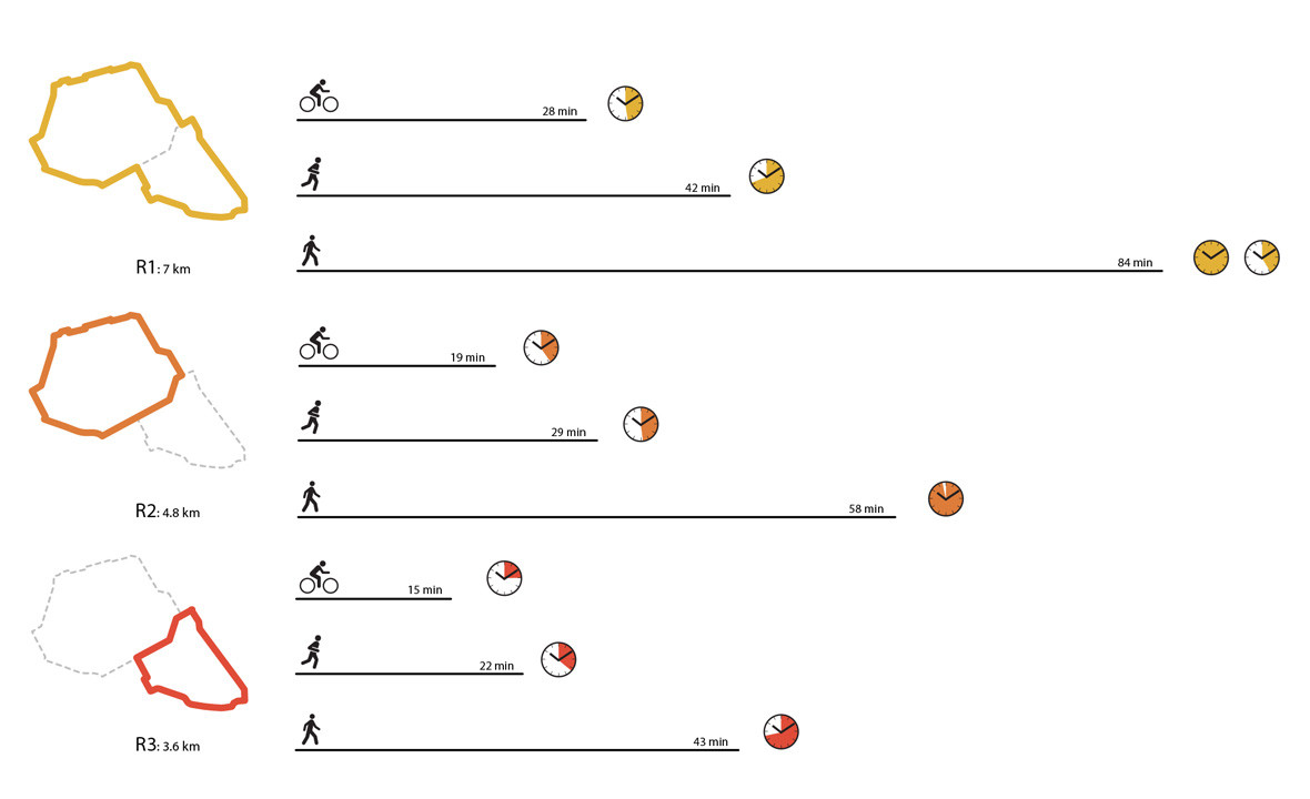
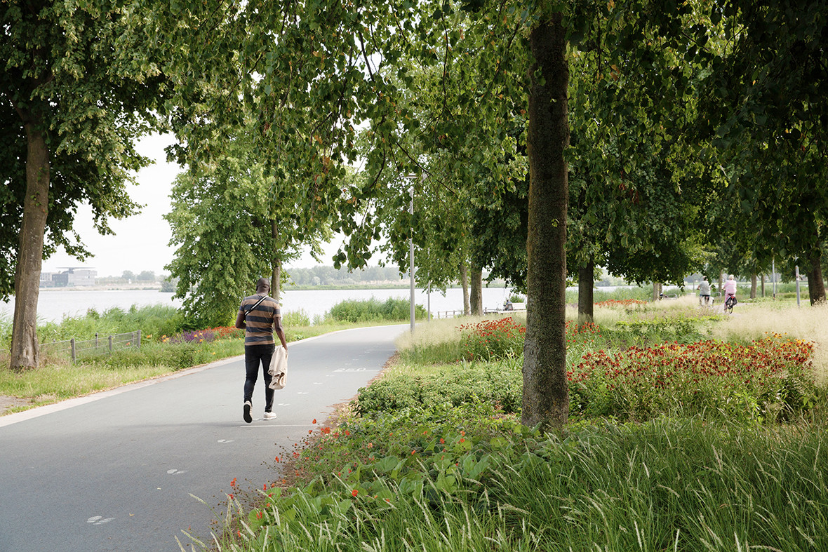
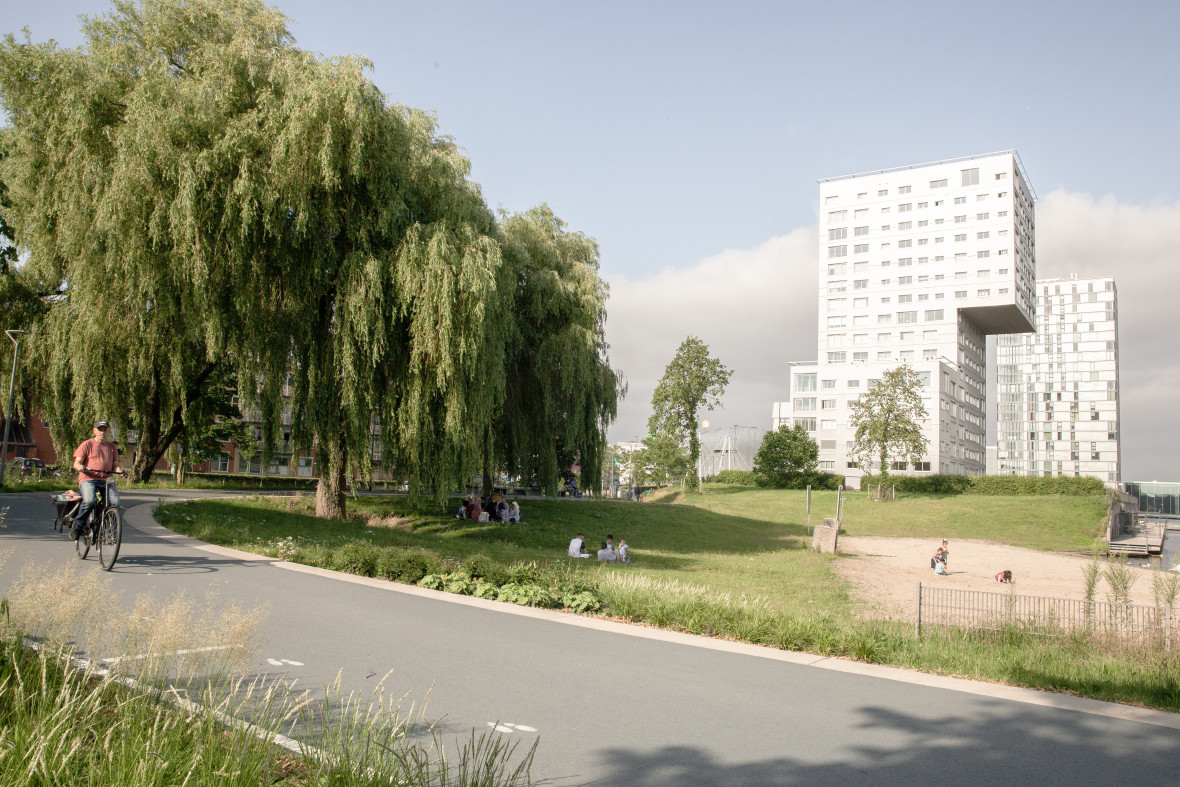
For the Weerwater to be meaningful, it is important that bordering residential districts join in. The Weerwater Route will connect all the surrounding neighbourhoods and fragmented park areas, while also contributing to a larger network of trails and routes. To do so, the design proposes a circular park around the water with a recreational cycling and walking trail: a seven kilometre Weerwater Route and a shorter route of approximately four kilometres.
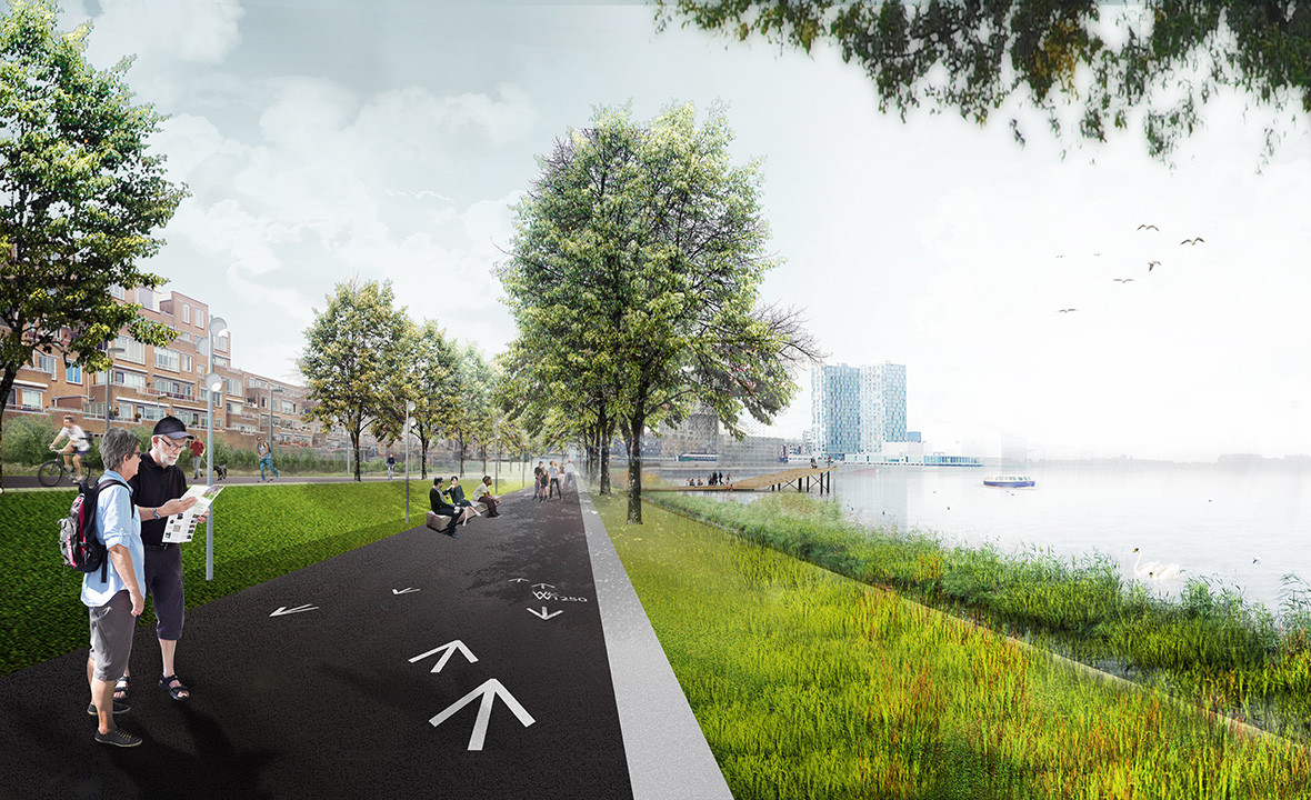
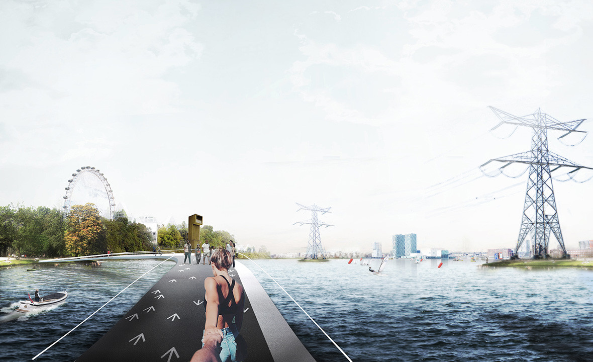
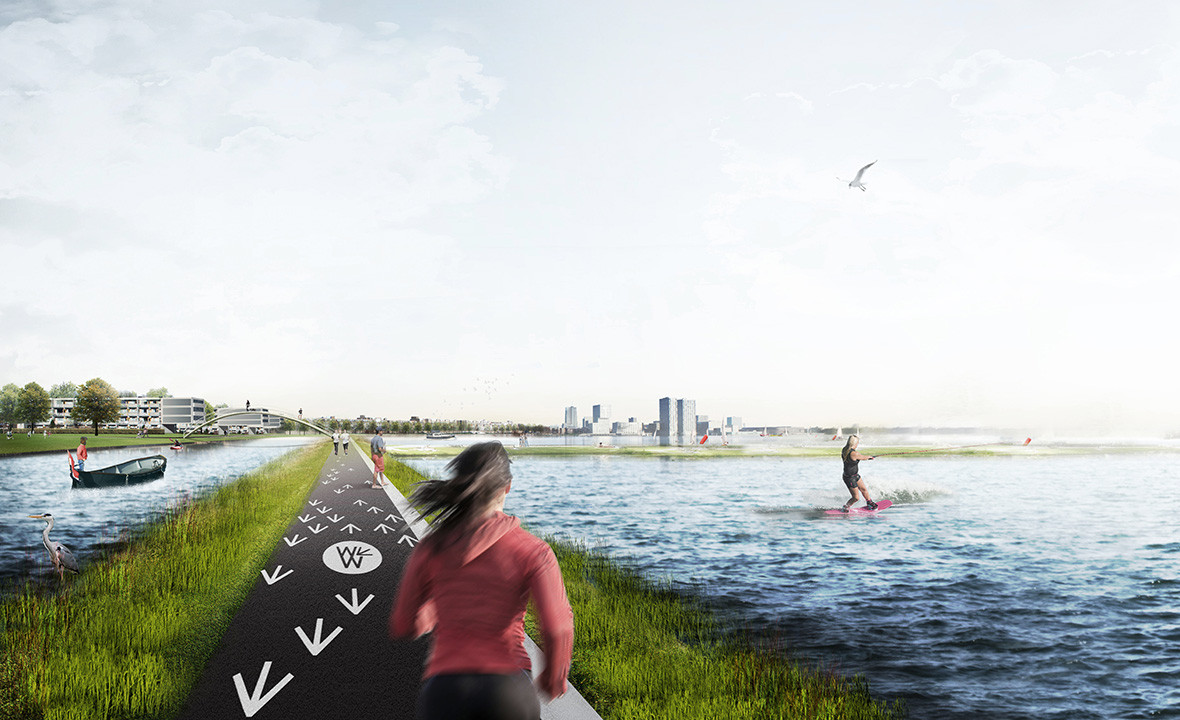
A continuous, well-traced path around the lake makes the Weerwater Route more recognisable. Design features include special edge detailing, furnishing and lighting, as well as clearly marked routes for walking, biking, and skating and eye-catching signs to mark the path structure. By creating recognisable locations and providing distance markers for athletes, an active route is formed along the banks. In addition, a series of striking “anchor points” make the water’s edge even more dynamic. These points are placed in strategic locations and are always visible from the previous anchor point, giving visitors and residents the feeling of being literally and figuratively transported. In this way, the Route is a narrative of places and spaces, a festive ribbon along the banks bringing more vibrancy to the Weerwater region.
Naturally, capturing a place’s identity takes more than a design and programming. It also needs to be communicated to the target users. A visual identity for the Route has been developed in collaboration with NorthernLight to reflect the location’s core values. This distinctive, unambiguous design fosters a sense of familiarity and reliability.

| Location. | Almere, Netherlands |
|---|---|
| Assignment | Programmatic vision and design for the Weerwater Route |
| Size | 450 hectares |
| Design | 2016 |
| Construction | 2018 - now |
| Status | Design public space, realized in parts |
| Client | Municipality of Almere |
| In collaboration with | NorthernLight, OverMorgen |