Oberbillwerder is one of the largest new urban development in Hamburg in decades, second only to HafenCity. With its proximity to a diverse natural area and culturally significant landscape, it will be an urban area brimming with water and ecological resources. In addition, the area contains an impressive potential to address Hamburg’s pressing housing crisis since it is located a mere 15 minutes from Hamburg inner City,

Throughout history, the landscape DNA of the area transformed from a panoramic marshland between the surrounding rivers into a picturesque drained and cultivated landscape divided into a pixel-like structure created by narrow canals. Over the last century, catalyzed by the railroad, the surrounding areas changed from pure green nature and small villages into a string of new suburban developments rapidly expanding the Hamburg metropolitan area into the situation we see today. This sub-urbanity developed principally in the 1960’s and continued throughout the 80’s and 90’s, leaving the urban tissue as smaller separated urban islands, with each their specific urban concept, housing typologies, water strategies, sports facilities and spatial identity.
The Connected City aims to be a source of inspiration that expands further than Hamburg and sets the agenda for similar sites across the world. A vibrant urban area with unique housing typologies, opportunities for recreation and new economic models. A city rooted in the history and cultural heritage of the landscape. An urban area that avoids transforming into another time capsule isolated island, but one that is focused on bringing cities together, connecting and stimulating. In doing so, it will put forward Hamburg’s second largest district (after HafenCity) as a model of inclusive, affordable, resilient and visionary planning.

The Connected City is fully embedded in the local landscape. It connects to the surrounding landscape through an active green blue network, that continues to grow from it while drawing its unique characteristics from the landscape itself. It follows the inherit linear landscape structure and brings a contrasting historical meandering to enrich it. It places and defines its neighborhoods based on landscape conditions: from low lying water (blue) areas to higher green neighborhoods and puts water at the heart of the city. The Connected City is not only physically connected to its surrounding landscape, it’s an extension of it in every way.
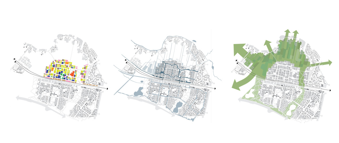
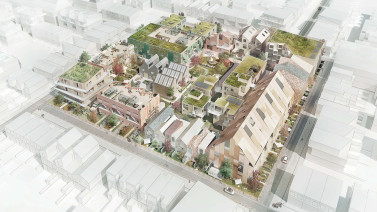
The Connected City stands for integrative development. The existing surrounding urban areas spread into the area, fusing to create more neighborhoods within Oberbillwerder. A simple and clear framework forms the basis of the plan. It is defined by preserving existing qualities of the landscape, such as its linear structure, the abundance of water, as well as the contrasting meandering of the dike. The water system becomes one of the central qualities of the development. A living working landscape machine, buffering and cleaning the water for reuse in a responsible manner, while at the same time providing high living quality for all. Within this base, reservations for infrastructure and green are defined, making landscape and public space the central framework of the development.

The Connected City is the healthy city of the future that places public spaces at its forefront. The Green Loop is the main feature of the public space network. It connects the neighborhoods with all major social infrastructure through a green artery that merges water, sports, play and city. The Green Loop will be a new form of urban landscape infrastructure prepared for the challenges of tomorrow. Next to The Green Loop, a network of Neighborhood Squares offers intimate, small scale places for community life while bringing together new forms of mobility, local services and culture.
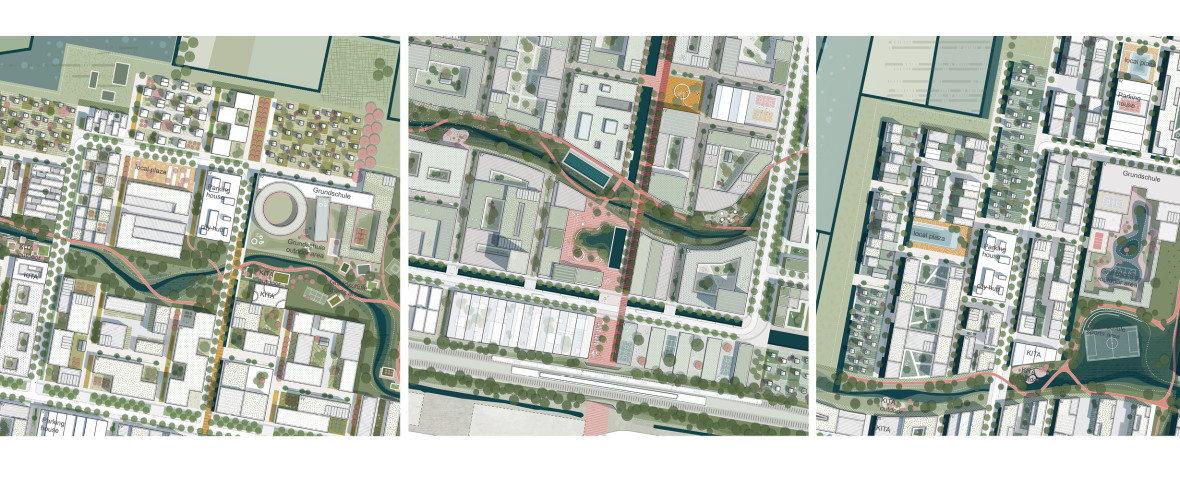
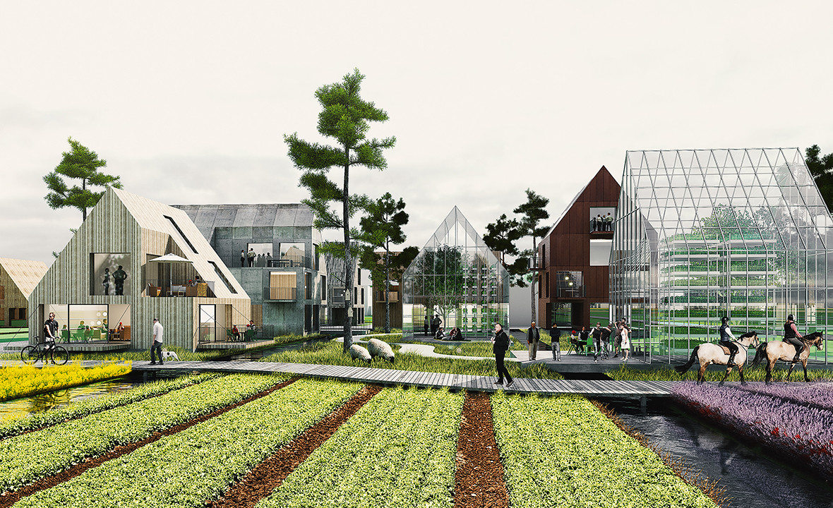
By means of this flexible framework, a mosaic of neighborhoods and qualities are formed. They draw their identities from the surrounding landscape to create a robust landscape living experience. Water retention and climate proofing is fundamentally embedded in each neighborhood and gives each its own identity. It creates different characters and opportunities locally. The streets therefore handle water in various ways; for example, in the low-lying blue area there are wider canals while in the green area large green bioswales and narrow blue streams dominate the structure. These distinctive landscape conditions stimulate unique identities in each neighborhood. They are all starting points for developing individual housing typologies and possible collective facilities from three floor canal row houses with platforms floating on the water to collective aquaponics to sustainable urban living.
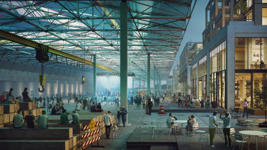
The general purpose of our programmatic strategy is to promote intensification, interaction and mixture. The urban areas are organized with a clear public space hierarchy so that future inhabitants can meet in a wide range of environments from the urban district center plaza and green boulevard, along the Green-Blue Arteries natural spaces, in organized and flexible sport zones of the parks in the green loop, well-defined unique neighborhood squares, temporary pockets and joker hide-outs; experiences reaching out to everyone while embracing a variety of interests. It is a new city typology; it is a blend of nature and city mixed together to create multiple hybrids and distinctive housing typologies.
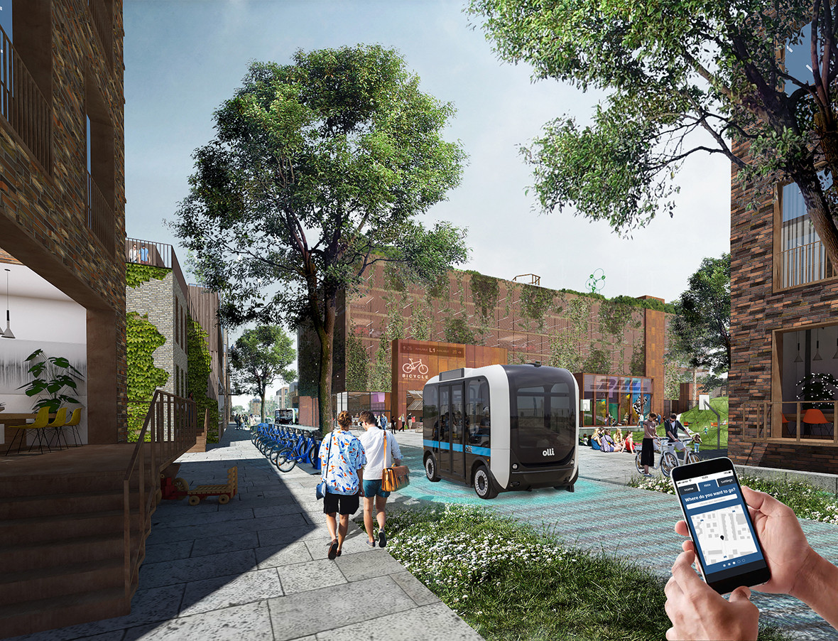
In The Connected City mobility is greater than Infrastructure. It is an ecosystem. It combines its own unique mobility concept with flexible infrastructure and innovative technologies. The Connected City will be an icon for the future of mobility. It anticipates the electrical and driverless revolution and puts forward a city that is ready to take back the streets. The Connected City blends a unique system of mobility hubs stimulating transfer between car, public transport, or bicycle. They are integrated in neighborhood centers as active elements of the city life, where small businesses, ateliers, warehouses, post etc. are mixed with parking. These buildings will be the batteries of the neighborhoods; producing and storing energy and, as car demand will decrease, they can evolve into new structures combining cultural programs, work, living, and parking for new modes of transport.
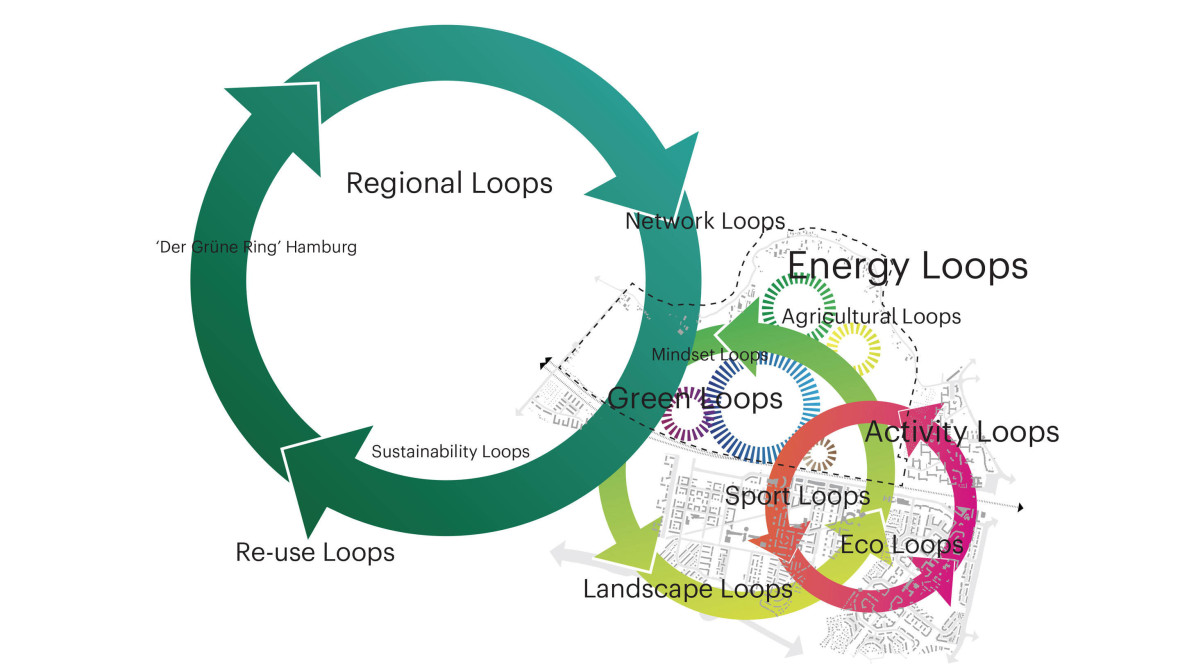
The Connected City is the performative city of the future. It is the largest European development to be pre-certified with the DGNB Platinum certification. It does not see sustainability as simple energy production and saving but a complex ecosystem that intertwines energy with water, green, mobility and social life of the city. Each flow in the city is complemented by the other. Nothing is left to chance or wasted in The Connected City. Streets and planting are oriented to ensure ideal climatic comfort, blocks are optimized to maximize solar orientation and PV efficiency, water and green become part of the DNA of the city while the mobility will generate and save energy instead of consuming. The city draws its unique ecosystem from the exchanges of flows. On top of that, The Connected City will showcase a state of the art sustainability and innovation in pilot projects and become areas for experimentation.
| Location. | Oberbillwerder - Hamburg, Germany |
|---|---|
| Assignment | Masterplan mixed use neighborhood |
| Size | 360 ha, 7.000 houses and 5.000 workplaces |
| Design | 2018 - now |
| Status | Competition 1st prize |
| Client | Hamburg Stadt, IBA Hamburg |
| In collaboration with | ADEPT, Transsolar, Büro Happold, Kraft |
| Copyright images | Doug & Wolf |